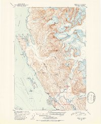
1952 Map of Juneau C-3
USGS Topo · Published 1953About this map
Tongass National Forest dominates this coastal landscape north of Juneau, where the transition from saltwater to ice fields is marked by massive glaciers and industrial mining attempts. The presence of the Bessie Mine and Eagle River Mine indicates the era's focus on extracting resources from the Yankee Basin and surrounding ridges. Connectivity in the early 1950s was centered on the Glacier Highway and the Montana Creek Trail, which provided access to the lower reaches of the Eagle River and Herbert River.
Find a feature on this map
35 named features on this map. Tap any name to fly to it.
Don’t see what you’re looking for? This feature index may not catch every label — zoom into the map to look around manually.
Map Details
Editions of this 1952 Juneau C-3 Map
2 editions found

Other maps of this area

1947 · Juneau B-3
USGS Topo · 1:63,360

1947 · Juneau B-2
USGS Topo · 1:63,360

1948 · Juneau B-4
USGS Topo · 1:63,360

1948 · Juneau C-4
USGS Topo · 1:63,360

1948 · Juneau D-3
USGS Topo · 1:63,360

1949 · Juneau B-3
USGS Topo · 1:62,500

1949 · Juneau B-2
USGS Topo · 1:62,500

1949 · Juneau D-4
USGS Topo · 1:63,360

1949 · Juneau C-4
USGS Topo · 1:63,360

1949 · Juneau D-3
USGS Topo · 1:63,360