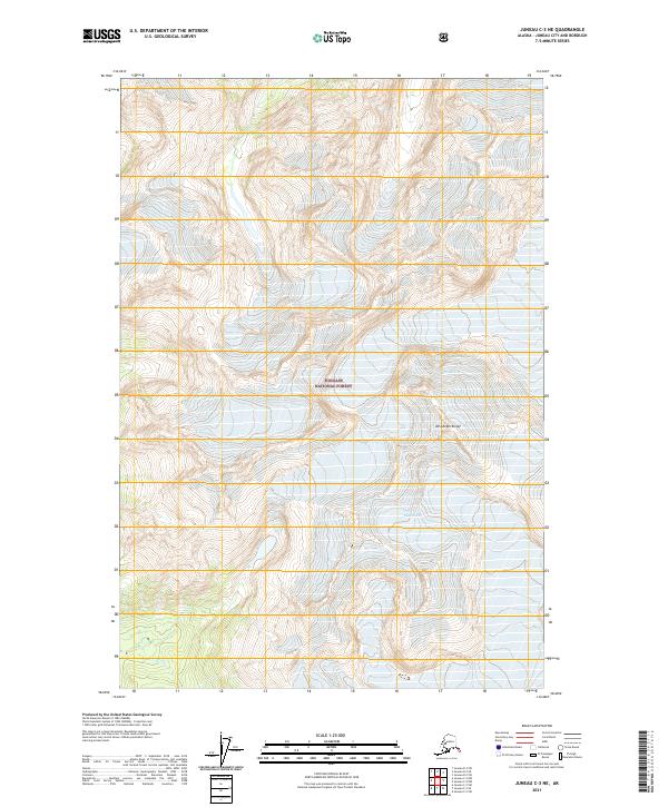
2021 Map of Juneau C-3 NE
USGS Topo · Published 2021About this map
Tongass National Forest dominates this Alaskan landscape, where the shifting ice of Eagle Glacier and Thiel Glacier defines the high-elevation terrain. This 2021 survey offers a detailed look at the complex glacial geography of the Juneau area, illustrating how the ice flows through the mountain passes. The map records the drainages of College Cr and Canyon Cr, which carry runoff from the ice fields toward the coast. Standing as a prominent landmark in the southeastern portion of the sheet, Mt Adolph Knopf provides a clear point of reference for navigating this unpopulated wilderness. The inclusion of public land survey boundaries, such as t37s r65e, provides the framework used for managing this protected coastal forest environment.
Find a feature on this map
10 named features on this map. Tap any name to fly to it.
Don’t see what you’re looking for? This feature index may not catch every label — zoom into the map to look around manually.
Map Details
Editions of this 2021 Juneau C-3 NE Map
This is the sole edition of this map. No revisions or reprints were ever made.
Other maps of this area

1948 · Juneau D-3
USGS Topo · 1:63,360

1949 · Juneau D-3
USGS Topo · 1:63,360

1951 · Juneau
USGS Topo · 1:250,000

1951 · Juneau C-3
USGS Topo · 1:63,360

1952 · Juneau C-3
USGS Topo · 1:63,360

1953 · Juneau D-3
USGS Topo · 1:63,360

1960 · Juneau C-2
USGS Topo · 1:63,360

1960 · Juneau D-2
USGS Topo · 1:63,360

1962 · Juneau
USGS Topo · 1:250,000
1986 · Juneau C-3 SW
USGS Topo · 1:25,000