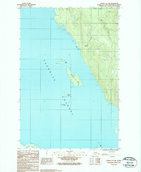
1986 Map of Juneau C-3 SW
USGS Topo · Published 1987About this map
Sentinel Island stands as a primary navigational landmark in the waters of the Favorite Channel within this 1980s coastal survey. The island is notable for its marked Lighthouse, providing essential guidance for maritime traffic navigating towards the inner passages of the City and Borough of Juneau. Along the shoreline, Yankee Cove and a nearby Dock indicate a nexus of water-to-land activity where the wilderness of the Tongass National Forest meets the sea.
Find a feature on this map
22 named features on this map. Tap any name to fly to it.
Don’t see what you’re looking for? This feature index may not catch every label — zoom into the map to look around manually.
Map Details
Editions of this 1986 Juneau C-3 SW Map
This is the sole edition of this map. No revisions or reprints were ever made.
Other maps of this area

1947 · Juneau B-3
USGS Topo · 1:63,360

1948 · Juneau B-4
USGS Topo · 1:63,360

1948 · Juneau C-4
USGS Topo · 1:63,360

1949 · Juneau B-3
USGS Topo · 1:62,500

1949 · Juneau C-4
USGS Topo · 1:63,360

1949 · Juneau B-4
USGS Topo · 1:63,360

1951 · Juneau
USGS Topo · 1:250,000

1951 · Juneau C-3
USGS Topo · 1:63,360

1952 · Juneau C-3
USGS Topo · 1:63,360

1962 · Juneau B-3
USGS Topo · 1:63,360