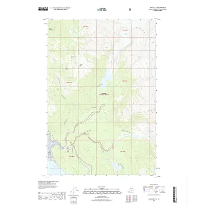
2017 Map of Juneau C-3 SE
USGS Topo · Published 2017About this map
Eagle Glacier and Herbert Glacier dominate the upper elevations of this terrain within the Tongass National Forest. The landscape is defined by the transition from the high Coast Mountains down to the shores of the Gulf of Alaska at Eagle Harbor. The drainage systems of the Eagle River and Herbert River create natural corridors through the wilderness, reflected in the network of historic routes. A concentrated system of trails, including the Amalga Trail, Yankee Basin Trail, and Windfall Lake Trail, suggests a long history of access to the high basins and lakes. The placement of the Glacier Highway and Herbert River Road near the coast highlights how modern infrastructure followed these established natural paths. For researchers, the presence of named features like Cottrell Basin and Thane Mtn provides specific points for tracing local geological and exploration history in the region north of Juneau.
Find a feature on this map
31 named features on this map. Tap any name to fly to it.
Don’t see what you’re looking for? This feature index may not catch every label — zoom into the map to look around manually.
Map Details
Editions of this 2017 Juneau C-3 SE Map
This is the sole edition of this map. No revisions or reprints were ever made.
Other maps of this area

1947 · Juneau B-3
USGS Topo · 1:63,360

1947 · Juneau B-2
USGS Topo · 1:63,360

1949 · Juneau B-3
USGS Topo · 1:62,500

1949 · Juneau B-2
USGS Topo · 1:62,500

1951 · Juneau
USGS Topo · 1:250,000

1951 · Juneau C-3
USGS Topo · 1:63,360

1952 · Juneau C-3
USGS Topo · 1:63,360

1960 · Juneau C-2
USGS Topo · 1:63,360

1962 · Juneau B-2
USGS Topo · 1:63,360

1962 · Juneau B-3
USGS Topo · 1:63,360