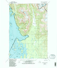
1950 Map of Juneau C-6
USGS Topo · Published 1987About this map
The coastal waters of Glacier Bay meet the towering heights of the Chilkat Range in this mid-century topographic record. While no towns or roads are shown, the map reveals a landscape defined by tidewater geography and the protected boundaries of the Glacier Bay National Park and the Tongass National Forest. The intricate shoreline of Hutchins Bay and the scattering of the Beardslee Islands, including Spider Island and Kidney Island, show the complexity of the maritime navigation routes through the Beardslee Entrance. The inland terrain is marked by major drainage systems like the Salmon River and Bartlett River, leading back from Bartlett Lake toward the interior peaks of the Endicott River Wilderness. This map captures the region at a time of early conservation, documenting the names and locations of islands like Puffin Island and Strawberry Island alongside landmarks like Miller Peak.
Find a feature on this map
32 named features on this map. Tap any name to fly to it.
Don’t see what you’re looking for? This feature index may not catch every label — zoom into the map to look around manually.
Map Details
Editions of this 1950 Juneau C-6 Map
3 editions found

Other maps of this area

1948 · Juneau C-5
USGS Topo · 1:63,360

1948 · Juneau B-6
USGS Topo · 1:63,360

1948 · Juneau C-6
USGS Topo · 1:63,360

1948 · Juneau B-5
USGS Topo · 1:63,360

1948 · Mount Fairweather B-1
USGS Topo · 1:63,360

1948 · Mount Fairweather D-1
USGS Topo · 1:63,360

1948 · Mount Fairweather C-1
USGS Topo · 1:63,360

1949 · Mount Fairweather C-1
USGS Topo · 1:63,360

1949 · Juneau D-6
USGS Topo · 1:63,360

1949 · Juneau D-5
USGS Topo · 1:63,360