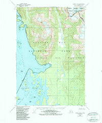
1950 Map of Juneau C-6
USGS Topo · Published 1988About this map
Glacier Bay National Park and the Tongass National Forest converge on this coastline, where the land and sea meet in a complex network of glacial inlets and islands. Compiled from 1948 aerial photography and 1950 field annotations, the map reveals a wilderness landscape defined by tidal activity and glacial recession. The Beardslee Islands cluster at the Beardslee Entrance, leading into the sheltered waters of Hutchins Bay and Beartrack Cove. Landward, Miller Peak and the Endicott River Wilderness rise above the drainage basins of the Bartlett River and Salmon River. This 1950 revision captures the coastal topography before later wilderness boundary adjustments, documenting the specific locations of Tidal Flats and landmarks like Strawberry Island and Eider Island that guide navigation through the unpredictable waters of Glacier Bay.
Find a feature on this map
32 named features on this map. Tap any name to fly to it.
Don’t see what you’re looking for? This feature index may not catch every label — zoom into the map to look around manually.
Map Details
Editions of this 1950 Juneau C-6 Map
3 editions found

Other maps of this area

1948 · Juneau C-5
USGS Topo · 1:63,360

1948 · Juneau B-6
USGS Topo · 1:63,360

1948 · Juneau C-6
USGS Topo · 1:63,360

1948 · Juneau B-5
USGS Topo · 1:63,360

1948 · Mount Fairweather B-1
USGS Topo · 1:63,360

1948 · Mount Fairweather D-1
USGS Topo · 1:63,360

1948 · Mount Fairweather C-1
USGS Topo · 1:63,360

1949 · Mount Fairweather C-1
USGS Topo · 1:63,360

1949 · Juneau D-6
USGS Topo · 1:63,360

1949 · Juneau D-5
USGS Topo · 1:63,360