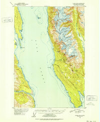
1951 Map of Juneau D-4
USGS Topo · Published 1952About this map
Mining operations in the Tongass National Forest define the industrial footprint of this mid-century coastline. While the rugged terrain east of Lynn Canal appears largely wild, the concentration of lode deposits is evident through a series of significant extraction sites clustered around Sherman Creek and Johnson Creek. These include the Ivanhoe Mine, Kensington Mine, and Jualin Mine, all noted as inactive by the time of this 1948 aerial survey. An Aerial Tram and a network of named points like Pt Sherman and Cove Point suggest a landscape shaped by maritime access to these upland resources. Out in the deep waters of the canal, the Eldred Rock Lighthouse stands as a critical navigational marker, while across the channel, the Endicott River delta and Sullivan Island frame the western shore.
Find a feature on this map
42 named features on this map. Tap any name to fly to it.
Don’t see what you’re looking for? This feature index may not catch every label — zoom into the map to look around manually.
Map Details
Editions of this 1951 Juneau D-4 Map
2 editions found

Other maps of this area

1948 · Juneau C-5
USGS Topo · 1:63,360

1948 · Juneau C-4
USGS Topo · 1:63,360

1948 · Juneau D-3
USGS Topo · 1:63,360

1948 · Skagway A-1
USGS Topo · 1:63,360

1949 · Atlin
USGS Topo · 1:250,000

1949 · Juneau D-5
USGS Topo · 1:63,360

1949 · Juneau D-4
USGS Topo · 1:63,360

1949 · Juneau C-4
USGS Topo · 1:63,360

1949 · Juneau D-3
USGS Topo · 1:63,360

1951 · Juneau
USGS Topo · 1:250,000