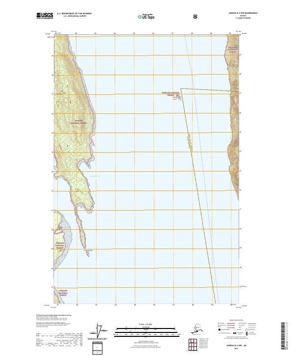
2021 Map of Juneau D-4 NW
USGS Topo · Published 2021About this map
Sullivan Island and its surrounding coastal waters dominate this remote portion of the Tongass National Forest. Located along the boundary separating the Juneau City and Borough and Haines Borough, the landscape is defined by its maritime geography and deep-water inlets. The sheltered waters of Rescue Harbor provide a significant natural anchorage on the eastern shore of the island, while isolated navigational landmarks like Eldred Rock and Sullivan Rock rise from the surrounding channel. This modern survey illustrates the preservation of these island terrains within the national forest system, documenting the exact township and range divisions including t33s r60e and t34s r61e. The map serves as a precise record of the rugged coastline and maritime boundaries in the Lynn Canal vicinity as they exist today.
Find a feature on this map
10 named features on this map. Tap any name to fly to it.
Don’t see what you’re looking for? This feature index may not catch every label — zoom into the map to look around manually.
Map Details
Editions of this 2021 Juneau D-4 NW Map
This is the sole edition of this map. No revisions or reprints were ever made.
Other maps of this area

1948 · Skagway A-1
USGS Topo · 1:63,360

1949 · Juneau D-5
USGS Topo · 1:63,360

1949 · Juneau D-4
USGS Topo · 1:63,360

1951 · Juneau
USGS Topo · 1:250,000

1951 · Skagway A-1
USGS Topo · 1:63,360

1951 · Juneau D-4
USGS Topo · 1:63,360

1952 · Skagway
USGS Topo · 1:250,000

1961 · Skagway
USGS Topo · 1:250,000

1962 · Juneau
USGS Topo · 1:250,000
1996 · Juneau D-5
USGS Topo · 1:63,360