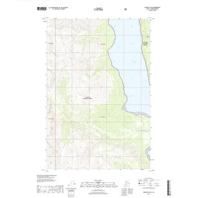
2017 Map of Juneau D-5 NE
USGS Topo · Published 2017About this map
Tongass National Forest dominates this coastal landscape, covering the steep, forested slopes that descend toward the intricate waterways of Southeast Alaska. The topography is defined by significant elevation changes, with ridges rising sharply from the eastern shore of Lynn Canal. This deep fjord serves as the primary maritime corridor for the region, while the narrow channel between the mainland and Sullivan Island provides a sheltered passage. The 2017 survey details the complex shoreline of this maritime wilderness, where glacial valleys and dense forest meet the sea within the Haines Borough. The map provides a precise view of the coastal boundary and the natural transition from high-altitude terrain to the marine environment of the Inside Passage.
Find a feature on this map
7 named features on this map. Tap any name to fly to it.
Don’t see what you’re looking for? This feature index may not catch every label — zoom into the map to look around manually.
Map Details
Editions of this 2017 Juneau D-5 NE Map
This is the sole edition of this map. No revisions or reprints were ever made.
Other maps of this area

1948 · Skagway A-1
USGS Topo · 1:63,360

1949 · Juneau D-5
USGS Topo · 1:63,360

1949 · Juneau D-4
USGS Topo · 1:63,360

1951 · Juneau
USGS Topo · 1:250,000

1951 · Skagway A-1
USGS Topo · 1:63,360

1951 · Juneau D-4
USGS Topo · 1:63,360

1952 · Skagway
USGS Topo · 1:250,000

1954 · Skagway A-2
USGS Topo · 1:63,360

1961 · Skagway
USGS Topo · 1:250,000

1962 · Juneau
USGS Topo · 1:250,000