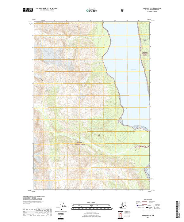
2021 Map of Juneau D-5 NE
USGS Topo · Published 2021About this map
Tongass National Forest dominates this coastal landscape in the Saint Elias Mountains of southeastern Alaska. The map centers on the high-relief terrain along the western shore of the Lynn Canal, where steep contours drop sharply into the waterway. A portion of Sullivan Island is visible along the eastern edge, showing the characteristic narrow channels and dramatic elevation changes that define this region. Managed by the U.S. Geological Survey, this 2021 edition provides a contemporary record of federal land boundaries and glacial topography in a wilderness area shaped by coastal fjords and high mountain peaks. The landscape is primarily undeveloped, reflecting the managed status of the national forest and the preservation of its coastal mountain environment.
Find a feature on this map
8 named features on this map. Tap any name to fly to it.
Don’t see what you’re looking for? This feature index may not catch every label — zoom into the map to look around manually.
Map Details
Editions of this 2021 Juneau D-5 NE Map
This is the sole edition of this map. No revisions or reprints were ever made.
Other maps of this area

1948 · Skagway A-1
USGS Topo · 1:63,360

1949 · Juneau D-5
USGS Topo · 1:63,360

1949 · Juneau D-4
USGS Topo · 1:63,360

1951 · Juneau
USGS Topo · 1:250,000

1951 · Skagway A-1
USGS Topo · 1:63,360

1951 · Juneau D-4
USGS Topo · 1:63,360

1952 · Skagway
USGS Topo · 1:250,000

1954 · Skagway A-2
USGS Topo · 1:63,360

1961 · Skagway
USGS Topo · 1:250,000

1962 · Juneau
USGS Topo · 1:250,000