Loading...
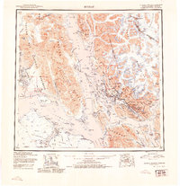
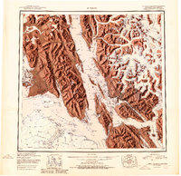
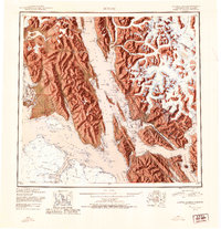
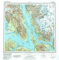
Loading map...1951 Map of Juneau
USGS Topo · Published 1954About this map
The territorial capital of Juneau and the neighboring community of Douglas anchor this mid-century reconnaissance of Southeast Alaska. Situated along the Gastineau Channel, these settlements represent the industrial and administrative hub of the region before statehood. The map illustrates the complex maritime and glacial geography of the Panhandle, from the Glacier Bay National Monument in the west to the international boundary with Canada along the Coast Mountains.
Find a feature on this map
51 named features on this map. Tap any name to fly to it.
Don’t see what you’re looking for? This feature index may not catch every label — zoom into the map to look around manually.
Map Details
Date Portrayed1951
Date Published1954
PublisherU.S. Geological Survey
Map TypeTopographic
Scale1:250,000
Physical Dimensions23.5 x 24.3 inches
Editions of this 1951 Juneau Map
4 editions found

Historical Maps of Juneau Through Time
Featured Locations
Source Details
SourceU.S. Geological Survey
CopyrightPublic Domain