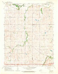
1963 Map of Juniata
USGS Topo · Published 1964About this map
Juniata sits along the southern bank of Table Rock Creek, a primary drainage through this central Kansas landscape where the Saline River meanders across the northern border. Published in 1964, the map reveals a rural transition zone defined by the convergence of Lincoln, Ottawa, and Saline counties. The Atchison Topeka and Santa Fe railroad line cuts a straight path across the terrain, passing through the small community of Glendale. Genealogists may find the isolated Monroe Cem of particular interest, located near the headwaters of Owl Creek. The map documents the intricate network of watercourses including Rock Creek and Mulberry Creek, which shaped the early agricultural settlement patterns and land divisions of Colorado, Morton, and Madison townships.
Find a feature on this map
18 named features on this map. Tap any name to fly to it.
Don’t see what you’re looking for? This feature index may not catch every label — zoom into the map to look around manually.
Map Details
Editions of this 1963 Juniata Map
2 editions found
Other maps of this area

1892 · Salina
USGS Topo · 1:125,000

1892 · Minneapolis
USGS Topo · 1:125,000

1894 · Ellsworth
USGS Topo · 1:125,000

1894 · Beloit
USGS Topo · 1:125,000

1942 · Salina
USGS Topo · 1:125,000

1955 · Brookville
USGS Topo · 1:24,000

1955 · Culver
USGS Topo · 1:24,000

1955 · Manhattan
USGS Topo · 1:250,000

1955 · Great Bend
USGS Topo · 1:250,000

1955 · Hutchinson
USGS Topo · 1:250,000