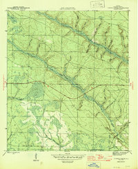
1945 Map of Juniper Creek
USGS Topo · Published 1945About this map
Juniper Creek and its complex network of tributaries define the landscape of Calhoun County in this mid-1940s survey. The area is characterized by an extensive system of watercourses and wetlands, including Bear Bay and the sprawling Buzzards Bay Swamp to the south. This environment is deeply marked by New Deal-era infrastructure, specifically the C C C Road No 16 and another C C C Road, which provided vital access through the dense pine flatwoods and swamps typical of the Florida Panhandle during this period.
Find a feature on this map
35 named features on this map. Tap any name to fly to it.
Don’t see what you’re looking for? This feature index may not catch every label — zoom into the map to look around manually.
Map Details
Editions of this 1945 Juniper Creek Map
3 editions found
Other maps of this area

1944 · Clarksville
USGS Topo · 1:31,680

1945 · Juniper Creek
USGS Topo · 1:31,680

1945 · Youngstown
USGS Topo · 1:31,680

1945 · Clarksville
USGS Topo · 1:31,680

1945 · Broad Branch
USGS Topo · 1:31,680

1945 · Frink
USGS Topo · 1:31,680

1945 · Fountain
USGS Topo · 1:31,680

1952 · Alford SE
USGS Topo · 1:24,000

1952 · Altha West
USGS Topo · 1:24,000
1952 · Compass Lake
USGS Topo · 1:24,000