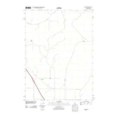
2011 Map of Juniper
USGS Topo · Published 2011About this map
Juniper serves as the focal point of this arid corridor in southern Idaho, situated where the high desert terrain meets a network of vital canyon passages. The settlement is anchored by a junction of local routes, including Juniper Rd and Hay Canyon Rd, which facilitate movement through the surrounding basins. The geography is defined by a series of prominent drainages and topographic depressions such as Saddle Horse Basin and the winding course of Meadow Creek.
Find a feature on this map
19 named features on this map. Tap any name to fly to it.
Don’t see what you’re looking for? This feature index may not catch every label — zoom into the map to look around manually.
Map Details
Editions of this 2011 Juniper Map
This is the sole edition of this map. No revisions or reprints were ever made.
Other maps of this area

1954 · Pocatello
USGS Topo · 1:250,000

1958 · Pocatello
USGS Topo · 1:250,000

1958 · Sublett
USGS Topo · 1:62,500

1959 · Strevell
USGS Topo · 1:62,500

1973 · Juniper
USGS Topo · 1:24,000

1973 · The Cove
USGS Topo · 1:24,000

1973 · Sublett Troughs
USGS Topo · 1:24,000
1973 · Roy
USGS Topo · 1:24,000

1973 · Black Pine
USGS Topo · 1:24,000
1973 · Badger Hole Spring
USGS Topo · 1:24,000