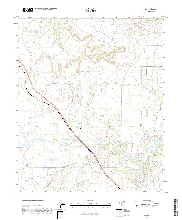
2022 Map of Justiceburg
USGS Topo · Published 2022About this map
The Double Mountain Fork Brazos River carves a winding path through the center of this Garza County landscape, where the flat Texas plains begin to break into more complex terrain. To the northeast, the aptly named The Badlands illustrate the erosive power of the region's drainage systems, including the Salt Br. This modern survey captures the area following the late-20th-century creation of Lake Alan Henry, a significant reservoir that now dominates the southeastern corner of the quadrangle. Local history and genealogy are centered near the small community of Justiceburg, marked here by the Justiceburg Cem and the nearby Justiceburg Lake. The transportation network is defined by a series of ranch-to-market roads and county routes like Co RD 298 and FM 2458, which connect isolated homesteads across the watershed of Griffin Cr and Sand Cr.
Find a feature on this map
20 named features on this map. Tap any name to fly to it.
Don’t see what you’re looking for? This feature index may not catch every label — zoom into the map to look around manually.
Map Details
Editions of this 2022 Justiceburg Map
This is the sole edition of this map. No revisions or reprints were ever made.
Other maps of this area

1954 · Lubbock
USGS Topo · 1:250,000

1954 · Big Spring
USGS Topo · 1:250,000

1958 · Big Spring
USGS Topo · 1:250,000

1969 · Cottonwood Creek
USGS Topo · 1:24,000

1969 · Gail NE
USGS Topo · 1:24,000

1969 · Justiceburg SE
USGS Topo · 1:24,000

1969 · Fluvanna
USGS Topo · 1:24,000
1969 · Justiceburg NW
USGS Topo · 1:24,000

1969 · Post East
USGS Topo · 1:24,000

1969 · Justiceburg
USGS Topo · 1:24,000