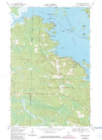
1969 Map of Kabetogama
USGS Topo · Published 1983About this map
Voyageurs National Park and the Kabetogama State Forest meet along a shoreline of intricate bays and islands in this 1969 survey. The small settlement of Kabetogama serves as the focal point for local activity, featuring the Kabetogama Ch and St Jude Chapel. The map documents a landscape defined by water and recreation, where Gappas Landing Campground and the Chief Wooden Frog Campground provide access to the expansive Kabetogama Lake. A seasonal Winter Trail cuts through the timbered terrain, reflecting the region's reliance on frozen ground for inland travel. To the west, the East Branch Rat Root River meanders toward the county line between Koochiching and St Louis counties. Notable landforms like Echo Island, Bald Eagle Island, and Stagies Point illustrate the complex geography of this Northwoods borderland.
Find a feature on this map
35 named features on this map. Tap any name to fly to it.
Don’t see what you’re looking for? This feature index may not catch every label — zoom into the map to look around manually.
Map Details
Editions of this 1969 Kabetogama Map
3 editions found

Other maps of this area

1954 · International Falls
USGS Topo · 1:250,000

1957 · International Falls
USGS Topo · 1:250,000

1958 · International Falls
USGS Topo · 1:250,000

1968 · Soldier Point
USGS Topo · 1:24,000

1968 · Daley Bay
USGS Topo · 1:24,000

1968 · Ash River SW
USGS Topo · 1:24,000

1969 · Ray SE
USGS Topo · 1:24,000

1969 · Island View
USGS Topo · 1:24,000

1969 · Ray
USGS Topo · 1:24,000

1969 · Ray SW
USGS Topo · 1:24,000