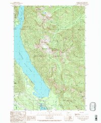
1989 Map of Kachess Lake
USGS Topo · Published 1989About this map
Wenatchee National Forest surrounds the deep basins of Kachess Lake and Little Kachess Lake in this late-1980s topographic study. The landscape is defined by the high elevations of Kachess Ridge and Cabin Mountain, where numerous peaks like Thorp Mountain and Amabilis Mountain overlook a network of seasonal drainages including Box Canyon Creek and Silver Creek. At the southern end of the lake, the infrastructure of the Kachess Dam and Kachess Gaging Station manages the water flow into the Yakima River. This era shows the developed recreation and transit facilities along the southern corridor, notably Lake Easton State Park and the Easton State Airport. The presence of transmission lines and the I-67 corridor indicates the region's importance as a utility and transportation artery through the mountain passes.
Find a feature on this map
46 named features on this map. Tap any name to fly to it.
Don’t see what you’re looking for? This feature index may not catch every label — zoom into the map to look around manually.
Map Details
Editions of this 1989 Kachess Lake Map
2 editions found
Other maps of this area

1901 · Snoqualmie Pass
USGS Topo · 1:125,000

1903 · Snoqualmie
USGS Topo · 1:125,000

1957 · Wenatchee
USGS Topo · 1:250,000

1961 · Snoqualmie Pass
USGS Topo · 1:62,500

1961 · Easton
USGS Topo · 1:62,500

1961 · Kachess Lake
USGS Topo · 1:62,500

1962 · Lester
USGS Topo · 1:62,500

1975 · Snoqualmie Pass
USGS Topo · 1:100,000

1989 · Easton
USGS Topo · 1:24,000
1989 · Ronald
USGS Topo · 1:24,000