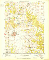
1950 Map of Kahoka
USGS Topo · Published 1950About this map
The Clark County seat of Kahoka serves as the central hub of this 1950 survey, where the intersection of two major railroads—the Atchison Topeka and Santa Fe and the Chicago Burlington and Quincy—defines the local economy. The landscape is characterized by a dense network of rural school districts and neighborhood churches, reflecting a mid-century agrarian society still oriented around small, localized institutions. Notable landmarks include the Lincoln College Sch near the town center and the County Fairgrounds to the southeast.
Find a feature on this map
39 named features on this map. Tap any name to fly to it.
Don’t see what you’re looking for? This feature index may not catch every label — zoom into the map to look around manually.
Map Details
Editions of this 1950 Kahoka Map
3 editions found
Other maps of this area

1903 · Kahoka
USGS Topo · 1:125,000

1949 · Wayland
USGS Topo · 1:24,000

1949 · Kahoka SE
USGS Topo · 1:24,000

1949 · Kahoka
USGS Topo · 1:24,000

1949 · St. Patrick
USGS Topo · 1:24,000

1950 · Kahoka
USGS Topo · 1:24,000

1950 · Saint Patrick
USGS Topo · 1:24,000

1950 · Kahoka SE
USGS Topo · 1:24,000

1950 · Wayland
USGS Topo · 1:24,000

1950 · Neeper
USGS Topo · 1:24,000