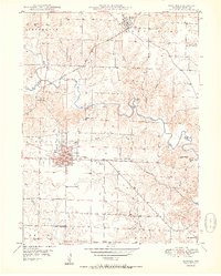
1950 Map of Kahoka
USGS Topo · Published 1950About this map
Kahoka serves as the focal point of this Clark County landscape, showing a grid of residential blocks and the County Fairgrounds just south of the Chicago Burlington and Quincy tracks. The surrounding rural townships, including Lincoln and Sweet Home, are defined by a network of one-room schoolhouses such as Oak Grove Sch and Little Fox Sch, which anchored these farming communities before the era of school consolidation.
Find a feature on this map
48 named features on this map. Tap any name to fly to it.
Don’t see what you’re looking for? This feature index may not catch every label — zoom into the map to look around manually.
Map Details
Editions of this 1950 Kahoka Map
3 editions found
Other maps of this area

1903 · Kahoka
USGS Topo · 1:125,000

1949 · Wayland
USGS Topo · 1:24,000

1949 · Kahoka SE
USGS Topo · 1:24,000

1949 · Kahoka
USGS Topo · 1:24,000

1949 · St. Patrick
USGS Topo · 1:24,000

1950 · Kahoka
USGS Topo · 1:24,000

1950 · Saint Patrick
USGS Topo · 1:24,000

1950 · Kahoka SE
USGS Topo · 1:24,000

1950 · Wayland
USGS Topo · 1:24,000

1950 · Neeper
USGS Topo · 1:24,000