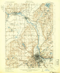
1918 Map of Kalamazoo
USGS Topo · Published 1932About this map
The city of Kalamazoo and the surrounding river valley are captured here just before the end of the First World War, showing a landscape defined by an extensive rail network and industrial growth. Major infrastructure such as the Otsego Dam and the State Hospital appear alongside the dense street grid of the city, which is flanked by the Riverside Cemetery and Recreation Park. The Kalamazoo River corridor serves as the primary artery for both commerce and transport, connecting the urban center to outlying paper-mill towns like Plainwell and Parchment.
Find a feature on this map
107 named features on this map. Tap any name to fly to it.
Don’t see what you’re looking for? This feature index may not catch every label — zoom into the map to look around manually.
Map Details
Editions of this 1918 Kalamazoo Map
4 editions found
Other maps of this area

1916 · Kalamazoo
USGS Topo · 1:62,500

1918 · Kalamazoo
USGS Topo · 1:62,500

1918 · Galesburg
USGS Topo · 1:62,500

1918 · Leonidas
USGS Topo · 1:62,500

1922 · Schoolcraft
USGS Topo · 1:62,500

1943 · Kalamazoo
USGS Topo · 1:62,500

1943 · Schoolcraft
USGS Topo · 1:62,500

1944 · Leonidas
USGS Topo · 1:62,500

1944 · Galesburg
USGS Topo · 1:62,500

1944 · Marcellus
USGS Topo · 1:62,500