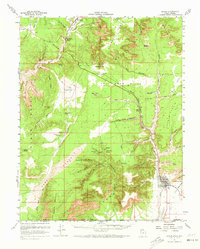
1957 Map of Kanab
USGS Topo · Published 1973About this map
The Kanab valley and the high plateau country of southern Utah are meticulously detailed in this mid-century survey, conducted shortly before the 1957 publication. The landscape is defined by massive geological benches, notably the White Cliffs and Vermilion Cliffs, which frame the lower drainages of Kanab Creek and the Virgin River. The settlement pattern follows the fertile Long Valley, where Mt Carmel and Mt Carmel Junction sit at the confluence of several canyons.
Find a feature on this map
96 named features on this map. Tap any name to fly to it.
Don’t see what you’re looking for? This feature index may not catch every label — zoom into the map to look around manually.
Map Details
Editions of this 1957 Kanab Map
2 editions found

Other maps of this area

1886 · Kanab
USGS Topo · 1:250,000

1886 · Kaibab
USGS Topo · 1:250,000

1953 · Cedar City
USGS Topo · 1:250,000

1953 · Grand Canyon
USGS Topo · 1:250,000

1954 · Kanab SW
USGS Topo · 1:24,000

1954 · Orderville Canyon SE
USGS Topo · 1:24,000

1954 · Fredonia NW
USGS Topo · 1:24,000

1954 · Kanab SE
USGS Topo · 1:24,000

1954 · Shinarump NW
USGS Topo · 1:24,000

1954 · Johnson SW
USGS Topo · 1:24,000