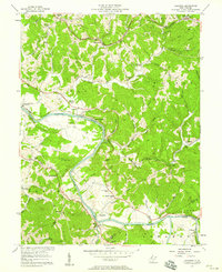
1957 Map of Kanawha
USGS Topo · Published 1958About this map
The Little Kanawha River carves a winding path through this portion of Wood County, creating prominent topographical landmarks like the Butcher Bend and Butcher Hill. During the mid-1950s, this landscape was defined by the industrial presence of numerous oil wells scattered among the ridges and the critical transportation corridor of the Baltimore and Ohio railroad. Small rural hubs such as Kanawha Station and Leachtown served the local community, which was well-supported by several country churches including Kanawha Chapel and Vaught Chapel.
Find a feature on this map
68 named features on this map. Tap any name to fly to it.
Don’t see what you’re looking for? This feature index may not catch every label — zoom into the map to look around manually.
Map Details
Editions of this 1957 Kanawha Map
4 editions found
Other maps of this area

1902 · Parkersburg
USGS Topo · 1:62,500

1904 · Parkersburg
USGS Topo · 1:62,500

1904 · Marietta
USGS Topo · 1:62,500

1906 · Elizabeth
USGS Topo · 1:62,500

1906 · Belleville
USGS Topo · 1:62,500

1924 · Belleville
USGS Topo · 1:62,500

1924 · Marietta
USGS Topo · 1:62,500

1924 · Elizabeth
USGS Topo · 1:62,500

1926 · Elizabeth
USGS Topo · 1:62,500

1926 · Belleville
USGS Topo · 1:62,500