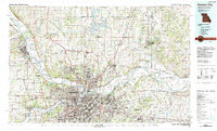
1983 Map of Kansas City
USGS Topo · Published 1983About this map
The confluence of the Missouri River and the Kansas River anchors this 1980s landscape, illustrating the massive industrial and suburban expansion across the Missouri-Kansas border. The map details the dense urban cores of Kansas City, Independence, and Leavenworth, linked by a complex web of interstate highways and heavy rail lines including the Burlington Northern and Santa Fe. Beyond the city centers, the transition to rural land is marked by significant public works and institutions, from the sprawling Kansas City International Airport to the Fort Leavenworth Military Reservation.
Find a feature on this map
174 named features on this map. Tap any name to fly to it.
Don’t see what you’re looking for? This feature index may not catch every label — zoom into the map to look around manually.
Map Details
Editions of this 1983 Kansas City Map
This is the sole edition of this map. No revisions or reprints were ever made.
Other maps of this area

1885 · Warrensburg
USGS Topo · 1:125,000

1885 · Atchison
USGS Topo · 1:125,000

1885 · Lawrence
USGS Topo · 1:125,000

1886 · Oskaloosa
USGS Topo · 1:125,000

1887 · Harrisonville
USGS Topo · 1:125,000

1887 · Olathe
USGS Topo · 1:125,000

1887 · Warrensburg
USGS Topo · 1:125,000

1888 · Oskaloosa
USGS Topo · 1:125,000

1888 · Atchison
USGS Topo · 1:125,000

1889 · Lexington
USGS Topo · 1:125,000