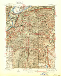
1940 Map of Kansas City
USGS Topo · Published 1940About this map
The Missouri River and Kansas River confluence serves as the industrial and transportation anchor for this urban landscape just before the United States entered the second World War. A dense network of rail lines, including the Wabash, Missouri Pacific, and Kansas City Terminal, snakes through the central city, feeding the stockyards and the extensive rail infrastructure surrounding Union Station. This era shows the city’s civic expansion in full detail, from the landmark Liberty Memorial and City Hall to the sprawling park system along The Paseo and Ward Parkway. Residential patterns are clearly defined by numerous local institutions, including Central High Schools, Westport High Sch, and specialized facilities like the Manual Training High Sch. To the south and west, the character shifts toward recreation and established estates, featuring the Kansas City Country Club and the vast Swope Park.
Find a feature on this map
58 named features on this map. Tap any name to fly to it.
Don’t see what you’re looking for? This feature index may not catch every label — zoom into the map to look around manually.
Map Details
Editions of this 1940 Kansas City Map
3 editions found
Other maps of this area

1887 · Harrisonville
USGS Topo · 1:125,000

1887 · Olathe
USGS Topo · 1:125,000

1890 · Kansas City
USGS Topo · 1:125,000

1892 · Harrisonville
USGS Topo · 1:125,000

1893 · Olathe
USGS Topo · 1:125,000

1894 · Kansas City
USGS Topo · 1:125,000

1894 · Harrisonville
USGS Topo · 1:125,000

1894 · Independence
USGS Topo · 1:125,000

1934 · Independence
USGS Topo · 1:24,000

1934 · Grandview
USGS Topo · 1:24,000