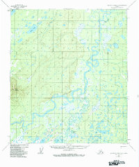
1952 Map of Kantishna River A-2
USGS Topo · Published 1984About this map
The Bearpaw River and the Kantishna River dominate this interior Alaskan landscape, creating a complex network of meanders, oxbows, and marshy lowlands typical of the region's subarctic drainage basins. This 1952 survey captures the area before modern infrastructure arrived, highlighting the essential role of seasonal transport routes such as the Bearpaw Sled Road. This trail provided a critical winter connection through the wilderness, linking isolated outposts like the Bearpaw Cabins and other remote Cabins to the river systems.
Find a feature on this map
16 named features on this map. Tap any name to fly to it.
Don’t see what you’re looking for? This feature index may not catch every label — zoom into the map to look around manually.
Map Details
Editions of this 1952 Kantishna River A-2 Map
4 editions found
Other maps of this area

1948 · Kantishna River
USGS Topo · 1:250,000

1951 · Kantishna River
USGS Topo · 1:250,000

1951 · Mount McKinley D-1
USGS Topo · 1:63,360

1952 · Mount McKinley
USGS Topo · 1:250,000

1952 · Kantishna River A-3
USGS Topo · 1:63,360

1952 · Kantishna River A-1
USGS Topo · 1:63,360

1952 · Kantishna River
USGS Topo · 1:250,000

1952 · Kantishna River A-2
USGS Topo · 1:63,360

1952 · Kantishna River B-1
USGS Topo · 1:63,360

1952 · Mount McKinley D-3
USGS Topo · 1:63,360