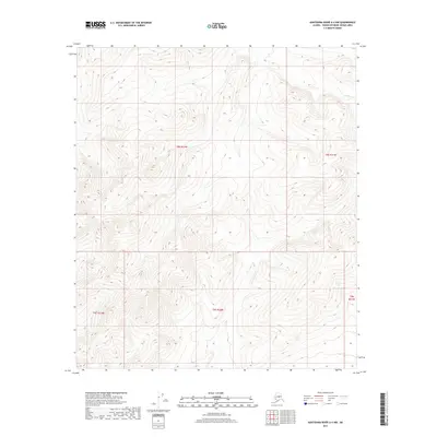
2017 Map of Kantishna River A-4 NW
USGS Topo · Published 2017About this map
High-altitude interior terrain dominates this region of Alaska, where the landscape is defined by the steep contouring of unnamed ridges and drainages. The map serves as a detailed study of the topographic relief within the Yukon-Koyukuk Census Area, showing a network of valleys and peaks that rise to over 2,500 feet. While the land remains undeveloped without named settlements or structures, the legal framework of the terrain is established by the grid boundaries of t8s r21w, t8s r22w, and t9s r22w. These township and range designations provide the primary points of reference for land navigation and geographic survey in this corner of the Unorganized Borough.
Find a feature on this map
5 named features on this map. Tap any name to fly to it.
Don’t see what you’re looking for? This feature index may not catch every label — zoom into the map to look around manually.
Map Details
Editions of this 2017 Kantishna River A-4 NW Map
This is the sole edition of this map. No revisions or reprints were ever made.
Other maps of this area

1948 · Kantishna River
USGS Topo · 1:250,000

1951 · Kantishna River
USGS Topo · 1:250,000

1952 · Kantishna River
USGS Topo · 1:250,000

1952 · Kantishna River A-5
USGS Topo · 1:63,360

1952 · Kantishna River B-5
USGS Topo · 1:63,360

1953 · Kantishna River B-4
USGS Topo · 1:63,360

1953 · Kantishna River A-4
USGS Topo · 1:63,360

1964 · Kantishna River
USGS Topo · 1:250,000
2017 · Kantishna River A-5 NE
USGS Topo · 1:25,000
2017 · Kantishna River A-5 SE
USGS Topo · 1:25,000