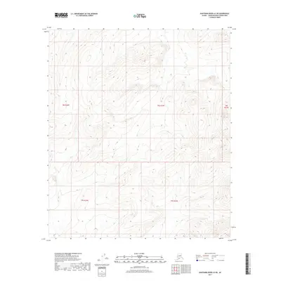
2017 Map of Kantishna River A-5 NE
USGS Topo · Published 2017About this map
The Interior Alaskan wilderness within the Yukon-Koyukuk Census Area is defined here by the systematic grid of the Public Land Survey System. Surveyed in 2017, the landscape is organized by the boundaries of T8s R24w, T8s R23w, and T8s R22w, alongside their southern counterparts T9s R24w and T9s R23w. This map represents a modern digital rendering of a remote and uninhabited terrain, where the absence of named physical features or settlements reflects the extreme isolation of the Kantishna River region. The topographic data provided by the National Elevation Dataset reveals a complex series of ridges and drainages that remain largely untouched by infrastructure, offering a clear view of the land's natural contours before any potential future development or shifts in the shifting river system.
Find a feature on this map
5 named features on this map. Tap any name to fly to it.
Don’t see what you’re looking for? This feature index may not catch every label — zoom into the map to look around manually.
Map Details
Editions of this 2017 Kantishna River A-5 NE Map
This is the sole edition of this map. No revisions or reprints were ever made.
Other maps of this area

1948 · Kantishna River
USGS Topo · 1:250,000

1951 · Kantishna River
USGS Topo · 1:250,000

1952 · Kantishna River
USGS Topo · 1:250,000

1952 · Kantishna River A-5
USGS Topo · 1:63,360

1952 · Kantishna River B-5
USGS Topo · 1:63,360

1953 · Kantishna River B-4
USGS Topo · 1:63,360

1953 · Kantishna River A-4
USGS Topo · 1:63,360

1964 · Kantishna River
USGS Topo · 1:250,000
2017 · Kantishna River A-5 SW
USGS Topo · 1:25,000
2017 · Kantishna River B-5 SW
USGS Topo · 1:25,000