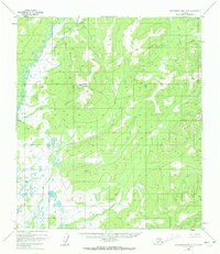
1952 Map of Kantishna River A-5
USGS Topo · Published 1972About this map
Haystack Mountain rises as a central landmark in this 1952 topographic study of the Alaska interior. The landscape is defined by the meandering course of the North Fork Kuskokwim River, which winds through the northwestern corner of the quadrangle. This map portrays a wild and undeveloped expanse, where the terrain transitions from the low-lying wetlands and complex oxbows of the river valley to the higher elevations of the surrounding ridges. The detailed surveying of swamplands and elevation contours reveals a territory shaped entirely by its natural hydrology and geomorphology, recorded just as photogrammetric mapping was beginning to document these remote reaches in the mid-20th century.
Find a feature on this map
2 named features on this map. Tap any name to fly to it.
Don’t see what you’re looking for? This feature index may not catch every label — zoom into the map to look around manually.
Map Details
Editions of this 1952 Kantishna River A-5 Map
3 editions found
Other maps of this area

1948 · Kantishna River
USGS Topo · 1:250,000

1951 · Kantishna River
USGS Topo · 1:250,000

1952 · Mount McKinley
USGS Topo · 1:250,000

1952 · Kantishna River
USGS Topo · 1:250,000

1952 · Kantishna River B-6
USGS Topo · 1:63,360

1952 · Kantishna River A-5
USGS Topo · 1:63,360

1952 · Kantishna River A-6
USGS Topo · 1:63,360

1952 · Kantishna River B-5
USGS Topo · 1:63,360

1953 · Kantishna River B-4
USGS Topo · 1:63,360

1953 · Kantishna River A-4
USGS Topo · 1:63,360