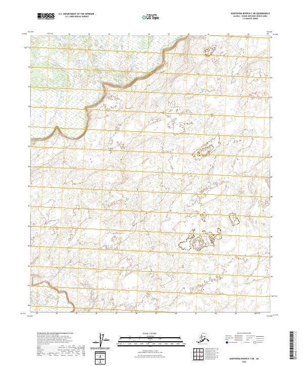
2024 Map of Kantishna River B-1 NE
USGS Topo · Published 2024About this map
Public Land Survey System boundaries define this interior section of the Yukon-Koyukuk Census Area, established through records from the T5s R13w and T6s R13w townships. This 2024 edition reflects contemporary Alaska, showing the precise alignment of survey lines across a landscape devoid of named settlements or infrastructure. The cartography reveals a complex network of wetland patterns and unnamed water bodies typical of the region's river-fed terrain. While the sheet includes the intersection of several ranges such as T5s R12w and T6s R14w, the absence of road networks or human-built structures underscores the preservation of this wilderness area in its modern state. The data presented is a synthesis of recent elevation models and hydrography datasets, offering a clear view of the natural topography in this specific corner of the Kantishna River basin.
Find a feature on this map
6 named features on this map. Tap any name to fly to it.
Don’t see what you’re looking for? This feature index may not catch every label — zoom into the map to look around manually.
Map Details
Editions of this 2024 Kantishna River B-1 NE Map
This is the sole edition of this map. No revisions or reprints were ever made.
Other maps of this area

1948 · Kantishna River
USGS Topo · 1:250,000

1950 · Fairbanks
USGS Topo · 1:250,000

1951 · Kantishna River
USGS Topo · 1:250,000

1951 · Fairbanks
USGS Topo · 1:250,000

1952 · Kantishna River C-1
USGS Topo · 1:63,360

1952 · Kantishna River
USGS Topo · 1:250,000

1952 · Kantishna River B-1
USGS Topo · 1:63,360

1952 · Fairbanks
USGS Topo · 1:250,000
1953 · Fairbanks C-6
USGS Topo · 1:63,360
1953 · Fairbanks B-6
USGS Topo · 1:63,360