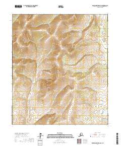
2017 Map of Kantishna River B-6 NE
USGS Topo · Published 2017About this map
Chitanana River flows through the northeastern corner of this interior Alaskan wilderness, cutting through the high elevation of the Yukon-Koyukuk region. This 2017 survey by the U.S. Geological Survey captures the intricate topography of the Tanana Valley area, dominated by steep ridgelines and deep drainage basins. The landscape is defined by the Public Land Survey System grids of t5s r26w, t5s r25w, t6s r26w, and t6s r25w, which provide the primary spatial framework for this roadless terrain. The map serves as a vital record of the natural hydrology and contour intervals in a part of the state where human development is virtually absent, focusing instead on the complex relief of the uplands and the winding path of the Chitanana River.
Find a feature on this map
5 named features on this map. Tap any name to fly to it.
Don’t see what you’re looking for? This feature index may not catch every label — zoom into the map to look around manually.
Map Details
Editions of this 2017 Kantishna River B-6 NE Map
This is the sole edition of this map. No revisions or reprints were ever made.
Other maps of this area

1948 · Kantishna River
USGS Topo · 1:250,000

1951 · Kantishna River
USGS Topo · 1:250,000

1952 · Kantishna River C-5
USGS Topo · 1:63,360

1952 · Kantishna River C-6
USGS Topo · 1:63,360

1952 · Kantishna River
USGS Topo · 1:250,000

1952 · Kantishna River B-6
USGS Topo · 1:63,360

1952 · Kantishna River B-5
USGS Topo · 1:63,360

1964 · Kantishna River
USGS Topo · 1:250,000
2017 · Kantishna River C-6 SE
USGS Topo · 1:25,000
2017 · Kantishna River C-6 SW
USGS Topo · 1:25,000