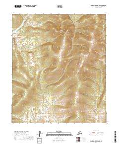
2017 Map of Kantishna River B-6 NW
USGS Topo · Published 2017About this map
The terrain within the Yukon-Koyukuk Census Area remains largely unpopulated and undeveloped in this early twenty-first-century survey. The landscape is defined by its topographic complexity, showing a series of ridges and drainages that lack named settlements, roads, or established infrastructure. The map detail focuses primarily on the Public Land Survey System divisions, specifically T5s R27w, T5s R26w, T6s R27w, and T6s R26w. This data provides a baseline for the region's wilderness state, where elevation contours and watercourse patterns are the primary markers of location in the absence of human-named landmarks or commercial development.
Find a feature on this map
4 named features on this map. Tap any name to fly to it.
Don’t see what you’re looking for? This feature index may not catch every label — zoom into the map to look around manually.
Map Details
Editions of this 2017 Kantishna River B-6 NW Map
This is the sole edition of this map. No revisions or reprints were ever made.
Other maps of this area

1948 · Kantishna River
USGS Topo · 1:250,000

1951 · Kantishna River
USGS Topo · 1:250,000

1951 · Ruby
USGS Topo · 1:250,000

1952 · Ruby B-1
USGS Topo · 1:63,360

1952 · Ruby C-1
USGS Topo · 1:63,360

1952 · Kantishna River C-6
USGS Topo · 1:63,360

1952 · Kantishna River
USGS Topo · 1:250,000

1952 · Kantishna River B-6
USGS Topo · 1:63,360

1952 · Ruby
USGS Topo · 1:250,000

1964 · Kantishna River
USGS Topo · 1:250,000