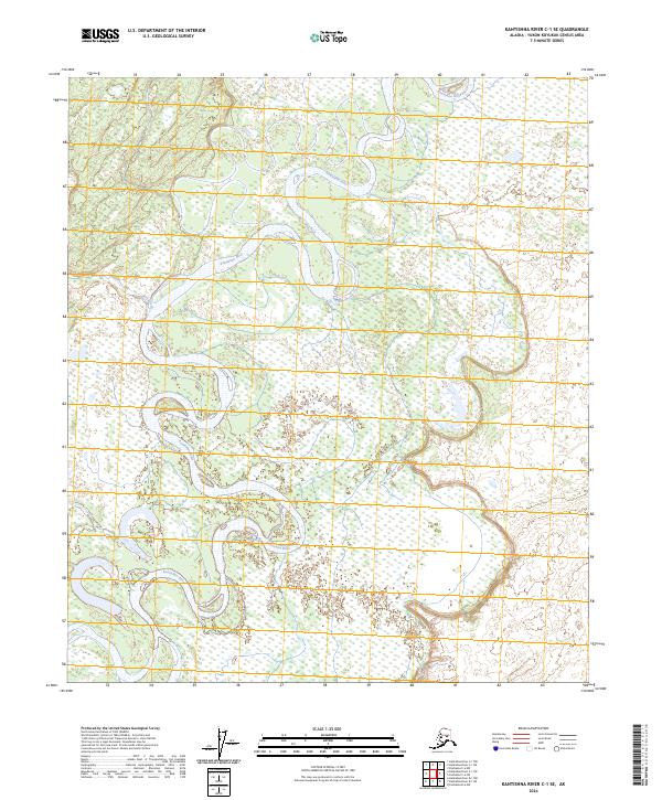
2024 Map of Kantishna River C-1 SE
USGS Topo · Published 2024About this map
The Kantishna River winds in deep, serpentine loops through this portion of the Yukon-Koyukuk Census Area. Characterized by a complex network of wetlands and oxbow lakes, the landscape demonstrates the dynamic nature of Alaskan river systems as they migrate across the lowlands. The lack of named settlements or roads underscores the wilderness character of the interior at the time of this 2024 survey. The topography is defined by the river's broad floodplains and the subtle elevations of the surrounding basin, where water dictates the structure of the land.
Find a feature on this map
8 named features on this map. Tap any name to fly to it.
Don’t see what you’re looking for? This feature index may not catch every label — zoom into the map to look around manually.
Map Details
Editions of this 2024 Kantishna River C-1 SE Map
This is the sole edition of this map. No revisions or reprints were ever made.
Other maps of this area

1948 · Kantishna River
USGS Topo · 1:250,000

1950 · Fairbanks
USGS Topo · 1:250,000

1951 · Kantishna River
USGS Topo · 1:250,000

1951 · Fairbanks
USGS Topo · 1:250,000

1952 · Kantishna River C-1
USGS Topo · 1:63,360

1952 · Kantishna River
USGS Topo · 1:250,000

1952 · Kantishna River B-1
USGS Topo · 1:63,360

1952 · Fairbanks
USGS Topo · 1:250,000
1953 · Fairbanks C-6
USGS Topo · 1:63,360
1953 · Fairbanks B-6
USGS Topo · 1:63,360