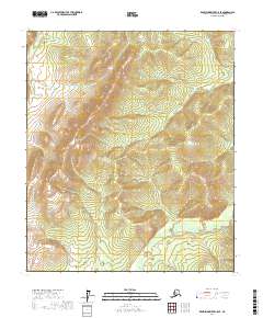
2017 Map of Kantishna River C-5 SE
USGS Topo · Published 2017About this map
Chitanatala Mountains dominate this interior Alaskan landscape, providing a rugged vertical backdrop for the winding Chitanana River as it flows through the western edge of the quadrangle. This 2017 study reflects the nearly untouched wilderness within the Yukon-Koyukuk Census Area, where the terrain is defined by high ridgelines and the drainages of the Kantishna River basin. Unlike more developed regions, this map is defined by natural survey markers and the Public Land Survey System grid, spanning townships such as t4s r23w and t5s r23w. The lack of named settlements or roads underscores the isolation of this subarctic environment, offering a clear view of the topography and hydrology before any significant human footprint appeared.
Find a feature on this map
9 named features on this map. Tap any name to fly to it.
Don’t see what you’re looking for? This feature index may not catch every label — zoom into the map to look around manually.
Map Details
Editions of this 2017 Kantishna River C-5 SE Map
This is the sole edition of this map. No revisions or reprints were ever made.
Other maps of this area

1948 · Kantishna River
USGS Topo · 1:250,000

1951 · Kantishna River
USGS Topo · 1:250,000

1952 · Kantishna River C-5
USGS Topo · 1:63,360

1952 · Kantishna River
USGS Topo · 1:250,000

1952 · Kantishna River B-5
USGS Topo · 1:63,360

1952 · Kantishna River C-4
USGS Topo · 1:63,360

1953 · Kantishna River B-4
USGS Topo · 1:63,360
1955 · Kantishna River C-4
USGS Topo · 1:63,360

1964 · Kantishna River
USGS Topo · 1:250,000
2017 · Kantishna River C-5 SW
USGS Topo · 1:25,000