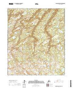
2017 Map of Kantishna River D-6 SW
USGS Topo · Published 2017About this map
The Little Mud River and Boney Cr carve a complex path through this segment of the Yukon-Koyukuk Census Area. This region, defined by its water systems and low-lying topography, exhibits a dense network of lakes and marshes typical of the Alaskan interior. The map illustrates the meandering nature of these waterways as they navigate the landscape, reflecting a wilderness environment where natural drainage patterns dictate the terrain. Geodetic and survey data from the U.S. Geological Survey and the Bureau of Land Management provide the structural framework for this remote territory, highlighting the importance of hydrographic tracking in an area largely untouched by permanent settlements or road infrastructure.
Find a feature on this map
8 named features on this map. Tap any name to fly to it.
Don’t see what you’re looking for? This feature index may not catch every label — zoom into the map to look around manually.
Map Details
Editions of this 2017 Kantishna River D-6 SW Map
This is the sole edition of this map. No revisions or reprints were ever made.
Other maps of this area

1948 · Kantishna River
USGS Topo · 1:250,000

1951 · Kantishna River
USGS Topo · 1:250,000

1951 · Ruby
USGS Topo · 1:250,000

1952 · Ruby C-1
USGS Topo · 1:63,360

1952 · Kantishna River C-6
USGS Topo · 1:63,360

1952 · Ruby D-1
USGS Topo · 1:63,360

1952 · Kantishna River
USGS Topo · 1:250,000

1952 · Kantishna River D-6
USGS Topo · 1:63,360

1952 · Ruby
USGS Topo · 1:250,000

1964 · Kantishna River
USGS Topo · 1:250,000