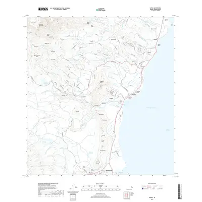
2017 Map of Kapaa
USGS Topo · Published 2017About this map
Sleeping Giant and Nounou Mtn anchor the coastal landscape of eastern Kauai in this 2017 survey, overlooking a dense network of settlements and agricultural water systems. The map illustrates the concentration of communities along the Pacific coast, from Kealia and Kapa'a in the north to Hanamaulu in the south. Inland, the complex hydrology of the Wailua River system is meticulously documented, featuring notable landmarks like Opaekaa Falls and the iconic Wailua Falls.
Find a feature on this map
138 named features on this map. Tap any name to fly to it.
Don’t see what you’re looking for? This feature index may not catch every label — zoom into the map to look around manually.
Map Details
Editions of this 2017 Kapaa Map
This is the sole edition of this map. No revisions or reprints were ever made.
Other maps of this area

1954 · Kauai
USGS Topo · 1:250,000

1963 · Anahola
USGS Topo · 1:24,000

1963 · Lihue
USGS Topo · 1:24,000

1963 · Kapaa
USGS Topo · 1:24,000

1963 · Koloa
USGS Topo · 1:24,000

1963 · Hanalei
USGS Topo · 1:24,000

1965 · Waialeale
USGS Topo · 1:24,000

1967 · Kauai
USGS Topo · 1:250,000

1970 · Kauai
USGS Topo · 1:250,000

1978 · Kapaa
USGS Topo · 1:24,000