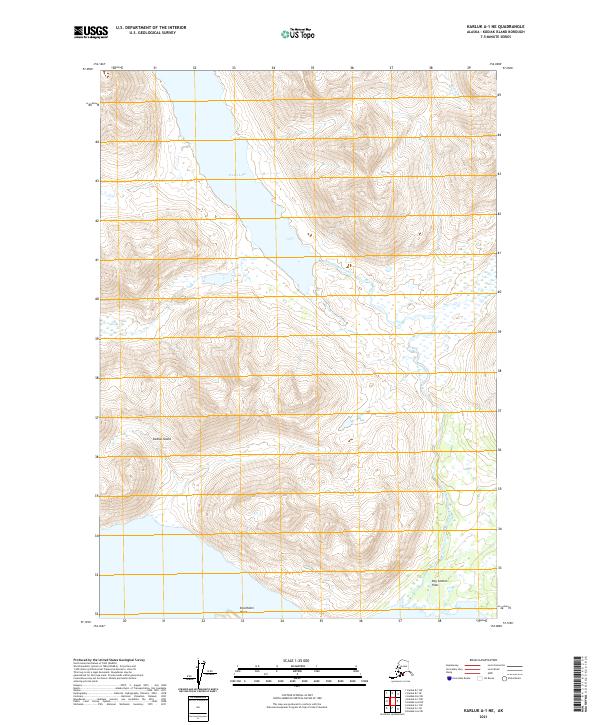
2021 Map of Karluk A-1 NE
USGS Topo · Published 2021About this map
Frazer Lake dominates the upper landscape of this remote interior portion of Kodiak Island, feeding into a complex hydrological system characterized by the meandering path of Dog Salmon Creek. This modern survey reveals a largely roadless wilderness where drainage patterns and topographic elevation are the primary features of the land. At the southern edge of the sheet, the waterway transitions into the broad, low-lying expanse of Dog Salmon Flats near Stockholm Point, indicating the seasonal shift in water levels and sediment transport across this subarctic environment. The presence of Cascade Cr in the northeast highlights the high-relief terrain that defines the perimeter of the lake basin, providing a detailed look at the island’s natural drainage before it reaches the sea.
Find a feature on this map
10 named features on this map. Tap any name to fly to it.
Don’t see what you’re looking for? This feature index may not catch every label — zoom into the map to look around manually.
Map Details
Editions of this 2021 Karluk A-1 NE Map
This is the sole edition of this map. No revisions or reprints were ever made.
Other maps of this area

1951 · Karluk
USGS Topo · 1:250,000

1952 · Kodiak
USGS Topo · 1:250,000

1952 · Karluk
USGS Topo · 1:250,000

1952 · Kodiak B-6
USGS Topo · 1:63,360

1952 · Karluk B-1
USGS Topo · 1:63,360

1952 · Karluk A-1
USGS Topo · 1:63,360

1952 · Kodiak A-6
USGS Topo · 1:63,360
1954 · Karluk A-1
USGS Topo · 1:63,360
1954 · Karluk B-1
USGS Topo · 1:63,360
1954 · Kodiak A-6
USGS Topo · 1:63,360