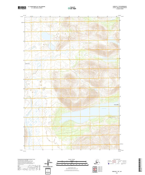
2021 Map of Karluk C-1 SE
USGS Topo · Published 2021About this map
Kodiak Island topography dominates this 2021 study, characterized by the winding course of the Karluk River as it traverses the western portion of the quadrangle. The map captures a significant coastal indentation at Larsen Bay, where the shoreline meets steep interior elevations. While much of the landscape remains roadless, the presence of the Landfill Access Road near the bay suggests localized infrastructure supporting the nearby community. The transition from the river valley to the surrounding peaks illustrates the traditional hydrology of the region, emphasizing the importance of the river system to the local geography. This survey provides a clear view of the island's interior and coastal interface before more recent environmental shifts, serving as a baseline for understanding the remote terrain and its drainage patterns.
Find a feature on this map
11 named features on this map. Tap any name to fly to it.
Don’t see what you’re looking for? This feature index may not catch every label — zoom into the map to look around manually.
Map Details
Editions of this 2021 Karluk C-1 SE Map
This is the sole edition of this map. No revisions or reprints were ever made.
Other maps of this area

1951 · Karluk
USGS Topo · 1:250,000

1952 · Kodiak
USGS Topo · 1:250,000

1952 · Karluk
USGS Topo · 1:250,000

1952 · Kodiak B-6
USGS Topo · 1:63,360

1952 · Karluk B-1
USGS Topo · 1:63,360

1952 · Karluk C-1
USGS Topo · 1:63,360

1952 · Kodiak C-6
USGS Topo · 1:63,360
1954 · Kodiak C-6
USGS Topo · 1:63,360
1954 · Karluk C-1
USGS Topo · 1:63,360
1954 · Karluk B-1
USGS Topo · 1:63,360