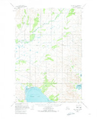
1951 Map of Karluk D-5
USGS Topo · Published 1974About this map
The Kejulik River snakes through this coastal Alaskan landscape, providing a central drainage for the high ridges that separate the interior from the Shelikof Strait. This 1951 survey reveals a territory defined by its water systems and the heavy influence of the tides, particularly evident in the broad Tidal Flat regions of Puale Bay and Alinchak Bay. The geography is oriented around drainage basins like those of Margaret Creek and Katrine Creek, which feed into larger water bodies from the surrounding peaks.
Find a feature on this map
16 named features on this map. Tap any name to fly to it.
Don’t see what you’re looking for? This feature index may not catch every label — zoom into the map to look around manually.
Map Details
Editions of this 1951 Karluk D-5 Map
2 editions found
Other maps of this area

1948 · Mt Katmai
USGS Topo · 1:250,000

1951 · Mt Katmai
USGS Topo · 1:250,000

1951 · Karluk
USGS Topo · 1:250,000

1951 · Mount Katmai A-6
USGS Topo · 1:63,360

1951 · Karluk D-6
USGS Topo · 1:63,360
1951 · Karluk C-4 and C-5
USGS Topo · 1:63,360

1951 · Karluk D-4
USGS Topo · 1:63,360

1951 · Mount Katmai A-4
USGS Topo · 1:63,360

1951 · Karluk D-5
USGS Topo · 1:63,360
1951 · Karluk C-6
USGS Topo · 1:63,360