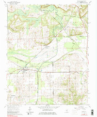
1966 Map of Karnak
USGS Topo · Published 1982About this map
Karnak and Belknap serve as the primary rail-connected hubs in this 1960s survey of Southern Illinois, where a complex network of wetlands and river engineering defines the landscape. The Cache River and its accompanying Old Cache River channel dominate the northern half, flowing through the Cache River State Game Refuge. To the south, the Post Creek Cutoff illustrates significant 20th-century drainage efforts designed to manage the slow-moving waters of the Little Black Slough and Quincy Slough.
Find a feature on this map
44 named features on this map. Tap any name to fly to it.
Don’t see what you’re looking for? This feature index may not catch every label — zoom into the map to look around manually.
Map Details
Editions of this 1966 Karnak Map
3 editions found
Other maps of this area

1918 · Vienna
USGS Topo · 1:62,500

1919 · Vienna
USGS Topo · 1:62,500

1920 · Dongola
USGS Topo · 1:62,500

1923 · Dongola
USGS Topo · 1:62,500

1928 · La Center
USGS Topo · 1:62,500

1931 · Cairo
USGS Topo · 1:62,500

1932 · La Center
USGS Topo · 1:62,500

1933 · Cairo
USGS Topo · 1:62,500

1939 · Cairo
USGS Topo · 1:62,500

1942 · Vienna
USGS Topo · 1:62,500