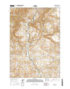
2017 Map of Kaskela
USGS Topo · Published 2017About this map
The Deschutes River carves a deep path through Wasco County, serving as the central axis for this landscape of canyons and high plateaus. Along its winding course, the river encounters turbulent stretches such as White Horse Rapids, while the small settlement of Kaskela sits near the riverbank at the mouth of Skookum Cr. The area is defined by its complex drainage systems, where seasonal and perennial flows like Antoken Cr and Swamp Cr feed into the main canyon.
Find a feature on this map
33 named features on this map. Tap any name to fly to it.
Don’t see what you’re looking for? This feature index may not catch every label — zoom into the map to look around manually.
Map Details
Editions of this 2017 Kaskela Map
This is the sole edition of this map. No revisions or reprints were ever made.
Other maps of this area

1928 · Madras
USGS Topo · 1:125,000

1930 · Dufur
USGS Topo · 1:125,000

1931 · Madras
USGS Topo · 1:125,000

1934 · Dufur
USGS Topo · 1:125,000

1953 · The Dalles
USGS Topo · 1:250,000

1955 · Bend
USGS Topo · 1:250,000

1956 · The Dalles
USGS Topo · 1:250,000

1957 · Bend
USGS Topo · 1:250,000

1957 · The Dalles
USGS Topo · 1:250,000

1958 · Bend
USGS Topo · 1:250,000