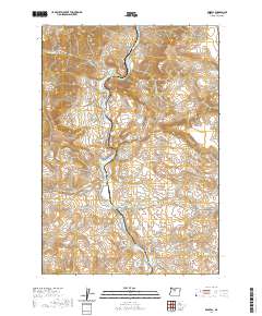
2020 Map of Kaskela
USGS Topo · Published 2020About this map
The Deschutes River carves a deep, winding canyon through the high desert of northern Oregon, acting as the central artery for this 2020 landscape. Near the settlement of Kaskela, the river churns through White Horse Rapids, a notable point for those navigating these waters. The topography is defined by significant elevation changes, particularly in the Mutton Mountains to the northwest and prominent geological formations like The Pot and Big Cove. A network of access roads, including Mutton Mtn Rd and S-Junction Rd, provides limited entry into this complex terrain. For local historians and researchers, the map identifies specific water sources and drainage systems such as Boiling Spring, Jersey School Spring, and Skookum Cr, which are essential markers of the area's hydrology and past land use patterns.
Find a feature on this map
33 named features on this map. Tap any name to fly to it.
Don’t see what you’re looking for? This feature index may not catch every label — zoom into the map to look around manually.
Map Details
Editions of this 2020 Kaskela Map
This is the sole edition of this map. No revisions or reprints were ever made.
Other maps of this area

1928 · Madras
USGS Topo · 1:125,000

1930 · Dufur
USGS Topo · 1:125,000

1931 · Madras
USGS Topo · 1:125,000

1934 · Dufur
USGS Topo · 1:125,000

1953 · The Dalles
USGS Topo · 1:250,000

1955 · Bend
USGS Topo · 1:250,000

1956 · The Dalles
USGS Topo · 1:250,000

1957 · Bend
USGS Topo · 1:250,000

1957 · The Dalles
USGS Topo · 1:250,000

1958 · Bend
USGS Topo · 1:250,000