
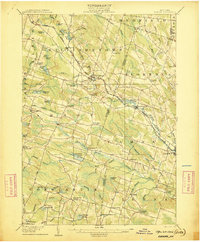
1906 Map of Kasoag
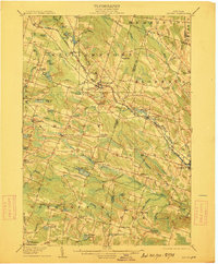
USGS Topo · Published 1947About this map
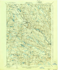
Williamstown and the surrounding townships of Amboy and Constantia define this landscape at the dawn of the twentieth century, when the region was a network of small hamlets and dairy-focused homesteads. The Rome Watertown and Ogdensburg Division of the New York Central and Hudson River RR serves as the primary artery for travel and transport, connecting settlements like Kasoag and Ricard to the larger markets of Central New York.
Find a feature on this map
71 named features on this map. Tap any name to fly to it.
Don’t see what you’re looking for? This feature index may not catch every label — zoom into the map to look around manually.
Map Details
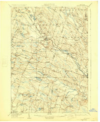
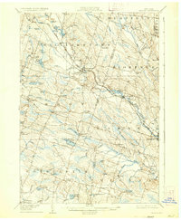
Editions of this 1906 Kasoag Map
7 editions found

Other maps of this area

1895 · Chittenango
USGS Topo · 1:62,500

1895 · Pulaski
USGS Topo · 1:62,500

1895 · Syracuse
USGS Topo · 1:62,500

1895 · Oneida
USGS Topo · 1:62,500

1898 · Oneida
USGS Topo · 1:62,500

1898 · Syracuse
USGS Topo · 1:62,500

1898 · Chittenango
USGS Topo · 1:62,500

1902 · Chittenango
USGS Topo · 1:62,500

1902 · Oneida
USGS Topo · 1:62,500

1903 · Orwell
USGS Topo · 1:62,500