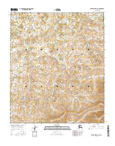
2016 Map of Kateel River A-2 SE
USGS Topo · Published 2016About this map
High-latitude terrain within the T5s R11e and T5s R12e townships characterizes this remote section of the Yukon-Koyukuk region. In this mid-2010s survey, the landscape is defined by complex contouring and numerous small water bodies, typical of the interior Alaskan wilderness. The map focuses heavily on the Public Land Survey System grid, providing precise boundary data for townships including T4s R10e and T6s R11e. These technical designations are essential for understanding land management and parceling in a territory where traditional named settlements are absent. The lack of infrastructure or roads on the sheet underscores the isolation of the Kateel River area during this era, serving as a primary reference for the physical geography and hydrology of the Alaskan interior.
Find a feature on this map
8 named features on this map. Tap any name to fly to it.
Don’t see what you’re looking for? This feature index may not catch every label — zoom into the map to look around manually.
Map Details
Editions of this 2016 Kateel River A-2 SE Map
This is the sole edition of this map. No revisions or reprints were ever made.
Other maps of this area

1945 · Nulato
USGS Topo · 1:250,000

1951 · Nulato
USGS Topo · 1:250,000

1951 · Kateel River
USGS Topo · 1:250,000

1952 · Nulato D-1
USGS Topo · 1:63,360

1952 · Kateel River A-2
USGS Topo · 1:63,360

1952 · Kateel River A-1
USGS Topo · 1:63,360

1952 · Nulato D-2
USGS Topo · 1:63,360

1952 · Nulato
USGS Topo · 1:250,000
1954 · Nulato D-2
USGS Topo · 1:63,360

1955 · Kateel River
USGS Topo · 1:250,000