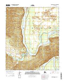
2015 Map of Kateel River A-4 SE
USGS Topo · Published 2015About this map
The Koyukuk River dominates this interior Alaska landscape, winding through the Yukon-Koyukuk region with a broad floodplain defined by shifting channels and backwaters. The map records the river's path through the northern reaches, where the Chips Slough branches off and the area known as the Long Stretch borders the western bank. This 2015 survey provides a modern snapshot of a classic riverine environment where the water's influence is seen in the intricate network of tributaries like Woodyard Cr. The absence of roads or permanent structures reflects the remote nature of this wilderness, emphasizing how the drainage patterns and terrain elevations dictated travel and land use in this part of the state.
Find a feature on this map
12 named features on this map. Tap any name to fly to it.
Don’t see what you’re looking for? This feature index may not catch every label — zoom into the map to look around manually.
Map Details
Editions of this 2015 Kateel River A-4 SE Map
This is the sole edition of this map. No revisions or reprints were ever made.
Other maps of this area

1945 · Nulato
USGS Topo · 1:250,000

1951 · Nulato
USGS Topo · 1:250,000

1951 · Kateel River
USGS Topo · 1:250,000

1952 · Nulato D-3
USGS Topo · 1:63,360

1952 · Kateel River A-4
USGS Topo · 1:63,360

1952 · Nulato D-4
USGS Topo · 1:63,360

1952 · Kateel River A-3
USGS Topo · 1:63,360

1952 · Nulato
USGS Topo · 1:250,000
1954 · Nulato D-3
USGS Topo · 1:63,360

1955 · Kateel River
USGS Topo · 1:250,000