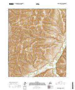
2017 Map of Kateel River A-6 NW
USGS Topo · Published 2017About this map
Kateel River and its tributary, Arvesta Creek, define the lower southern landscape of this territory within the Nulato Hills. This survey reflects a predominantly undeveloped region of the Yukon-Koyukuk Census Area, where the drainage patterns of the river provide the primary navigational and geographic markers. The terrain transitions from the low-lying river valley in the southeast toward more elevated topography in the northern sections of the map, illustrating the remote and natural character of the Alaskan interior as it remained in the early 21st century. The absence of roads or established settlements emphasizes the wilderness state of the region, where topographical details and watercourses remain the most significant features for tracing land use or historical movement.
Find a feature on this map
9 named features on this map. Tap any name to fly to it.
Don’t see what you’re looking for? This feature index may not catch every label — zoom into the map to look around manually.
Map Details
Editions of this 2017 Kateel River A-6 NW Map
This is the sole edition of this map. No revisions or reprints were ever made.
Other maps of this area

1951 · Candle
USGS Topo · 1:250,000

1951 · Kateel River
USGS Topo · 1:250,000

1954 · Candle A-1
USGS Topo · 1:63,360

1954 · Candle B-1
USGS Topo · 1:63,360
1955 · Kateel River A-6
USGS Topo · 1:63,360
1955 · Kateel River B-6
USGS Topo · 1:63,360

1955 · Kateel River
USGS Topo · 1:250,000

1955 · Candle
USGS Topo · 1:250,000

1964 · Candle
USGS Topo · 1:250,000
2015 · Candle B-1 SE
USGS Topo · 1:25,000