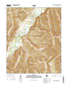
2015 Map of Kateel River B-5 NW
USGS Topo · Published 2015About this map
The Kateel River winds through the heart of this Yukon-Koyukuk landscape, defining a complex topography of ridges and drainage basins. Its wandering course across the western sections contrast with the more structured elevations that rise toward the east. In the southeastern portion of the quadrangle, the Pitka River makes a brief appearance, carving its own path through the terrain. The map's surveyed boundaries, including t1n r2e and t1s r3e, reveal the underlying township and range grid used to organize this remote Alaskan interior. This 2015 representation captures a landscape dominated by natural hydrological patterns, where the rivers serve as the primary landmarks in an area defined by its lack of human infrastructure and named settlements.
Find a feature on this map
6 named features on this map. Tap any name to fly to it.
Don’t see what you’re looking for? This feature index may not catch every label — zoom into the map to look around manually.
Map Details
Editions of this 2015 Kateel River B-5 NW Map
This is the sole edition of this map. No revisions or reprints were ever made.
Other maps of this area

1951 · Kateel River
USGS Topo · 1:250,000

1954 · Kateel River B-5
USGS Topo · 1:63,360

1954 · Kateel River C-6
USGS Topo · 1:63,360

1955 · Kateel River B-5
USGS Topo · 1:63,360
1955 · Kateel River B-6
USGS Topo · 1:63,360
1955 · Kateel River C-5
USGS Topo · 1:63,360

1955 · Kateel River
USGS Topo · 1:250,000
2015 · Kateel River C-5 SE
USGS Topo · 1:25,000
2015 · Kateel River B-5 SE
USGS Topo · 1:25,000
2015 · Kateel River B-5 NE
USGS Topo · 1:25,000