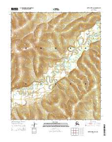
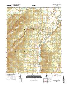
2015 Map of Kateel River C-5 SE
USGS Topo · Published 2015About this map
The Kateel River meanders extensively through this interior Alaskan wilderness, carving a serpentine path through the lowland valleys. The topography is defined by high ridges in the west, reaching elevations that contrast sharply with the river's broad, marshy floodplain to the east. This 2015 survey illustrates the classic geomorphology of the region, where the river's loop-and-bend pattern creates numerous oxbow formations and wetlands. This area, largely devoid of named settlements or roads, is organized by the Public Land Survey System into townships including t3n r3e, t2n r4e, and t1n r4e. The map serves as a detailed record of the natural hydrology and drainage patterns of the Yukon-Koyukuk region during the early 21st century.
Find a feature on this map
7 named features on this map. Tap any name to fly to it.
Don’t see what you’re looking for? This feature index may not catch every label — zoom into the map to look around manually.
Map Details
Editions of this 2015 Kateel River C-5 SE Map
This is the sole edition of this map. No revisions or reprints were ever made.
Other maps of this area

1951 · Kateel River
USGS Topo · 1:250,000

1952 · Kateel River B-4
USGS Topo · 1:63,360

1954 · Kateel River C-4
USGS Topo · 1:63,360

1954 · Kateel River B-5
USGS Topo · 1:63,360

1955 · Kateel River B-5
USGS Topo · 1:63,360
1955 · Kateel River C-5
USGS Topo · 1:63,360

1955 · Kateel River
USGS Topo · 1:250,000
2015 · Kateel River B-5 NE
USGS Topo · 1:25,000
2015 · Kateel River B-5 NW
USGS Topo · 1:25,000
2015 · Kateel River B-4 NW
USGS Topo · 1:25,000