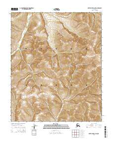
2015 Map of Kateel River B-6 NW
USGS Topo · Published 2015About this map
The Continental Divide traverses this portion of the Alaskan interior, marking a significant topographical transition within the Yukon-Koyukuk region. In the northwestern corner of the quadrangle, the Tagagawik River meanders through the high-elevation terrain, its course defined by the surrounding drainage patterns of the Seward Peninsula’s inland reaches. This 2015 survey, produced by the U.S. Geological Survey, illustrates a landscape dominated by relief and natural hydrology, with surveyors utilizing North American Datum of 1983 standards to map these remote coordinates. The presence of the divide suggests a high alpine environment where water systems are diverted toward different oceanic basins, a fundamental feature for understanding the physical geography of Northern Alaska.
Find a feature on this map
8 named features on this map. Tap any name to fly to it.
Don’t see what you’re looking for? This feature index may not catch every label — zoom into the map to look around manually.
Map Details
Editions of this 2015 Kateel River B-6 NW Map
This is the sole edition of this map. No revisions or reprints were ever made.
Other maps of this area

1951 · Candle
USGS Topo · 1:250,000

1951 · Kateel River
USGS Topo · 1:250,000

1954 · Candle C-1
USGS Topo · 1:63,360

1954 · Candle B-1
USGS Topo · 1:63,360

1954 · Kateel River C-6
USGS Topo · 1:63,360
1955 · Kateel River B-6
USGS Topo · 1:63,360

1955 · Kateel River
USGS Topo · 1:250,000

1955 · Candle
USGS Topo · 1:250,000

1964 · Candle
USGS Topo · 1:250,000
2015 · Candle B-1 SE
USGS Topo · 1:25,000