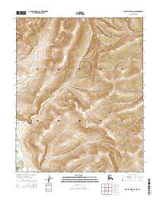
2015 Map of Kateel River C-6 NW
USGS Topo · Published 2015About this map
The Tagagawik River flows across the southwestern corner of this 2015 survey, carving a path through the expansive terrain of the Kateel River C-6 NW quadrangle. This specific quadrant of the Yukon-Koyukuk region reflects the immense, unpopulated interior of Alaska, where the landscape is defined by its hydrography and elevation rather than human settlement. The topographic contours highlight the undulating elevation of the uplands, with the river valley serving as the primary geographic reference point for the entire sheet. Because the area lacks named towns or roads, the map serves as a vital record for understanding the natural drainage patterns and land divisions within the Public Land Survey System, specifically across Township 4 North and Township 3 North. It represents a modern standard of precision for an area of the state that remains largely untouched by infrastructure.
Find a feature on this map
7 named features on this map. Tap any name to fly to it.
Don’t see what you’re looking for? This feature index may not catch every label — zoom into the map to look around manually.
Map Details
Editions of this 2015 Kateel River C-6 NW Map
This is the sole edition of this map. No revisions or reprints were ever made.
Other maps of this area

1951 · Candle
USGS Topo · 1:250,000

1951 · Kateel River
USGS Topo · 1:250,000
1954 · Candle D-1
USGS Topo · 1:63,360

1954 · Candle C-1
USGS Topo · 1:63,360

1954 · Kateel River D-6
USGS Topo · 1:63,360

1954 · Kateel River C-6
USGS Topo · 1:63,360

1955 · Kateel River
USGS Topo · 1:250,000

1955 · Candle
USGS Topo · 1:250,000

1964 · Candle
USGS Topo · 1:250,000
2015 · Kateel River D-6 SE
USGS Topo · 1:25,000