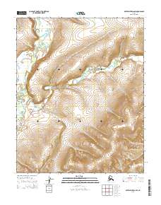
2015 Map of Kateel River D-6 SW
USGS Topo · Published 2015About this map
Tagagawik River meanders through the northwest corner of this remote Alaskan interior landscape, defining a wide river valley that contrasts with the surrounding uplands. The drainage patterns are further shaped by Derby Creek, which cuts through the central and southern portions of the territory. This map emphasizes the complex hydrography of the Yukon-Koyukuk region, revealing how these watercourses carve through the terrain within various township and range blocks such as t6n r1w and t5n r1w. The contour intervals illustrate the significant elevation changes that separate these drainages, providing a clear view of the natural corridors used for navigation and travel in the Alaskan bush before modern development.
Find a feature on this map
11 named features on this map. Tap any name to fly to it.
Don’t see what you’re looking for? This feature index may not catch every label — zoom into the map to look around manually.
Map Details
Editions of this 2015 Kateel River D-6 SW Map
This is the sole edition of this map. No revisions or reprints were ever made.
Other maps of this area

1951 · Candle
USGS Topo · 1:250,000

1951 · Kateel River
USGS Topo · 1:250,000
1954 · Candle D-1
USGS Topo · 1:63,360

1954 · Candle C-1
USGS Topo · 1:63,360

1954 · Kateel River D-6
USGS Topo · 1:63,360

1954 · Kateel River C-6
USGS Topo · 1:63,360

1955 · Kateel River
USGS Topo · 1:250,000

1955 · Candle
USGS Topo · 1:250,000

1964 · Candle
USGS Topo · 1:250,000
2015 · Kateel River D-6 SE
USGS Topo · 1:25,000